 In an era where the physical and digital worlds converge, geospatial AI stands at the forefront of a technological revolution, redefining how we interact with the spaces around us.
At its core, geospatial AI merges the rich, location-based tapestry of geospatial data—maps, satellite imagery, GPS tracks, and beyond—with the transformative power of artificial intelligence.
By harnessing machine learning, computer vision, and natural language processing, it transforms raw data into dynamic insights, enabling everything from smarter cities to immersive augmented reality experiences.
This book explores the boundless potential of geospatial AI, delving into its applications, challenges, and the profound impact it promises across industries.
Niantic
Consider the journey of Niantic, a company once synonymous with Pokémon Go, which has boldly pivoted to form Niantic Spatial—a venture dedicated to geospatial AI. By leveraging vast datasets crowdsourced from millions of players, Niantic Spatial is crafting digital maps of unparalleled detail, poised to empower robotics, AR smart glasses, and autonomous navigation.
This shift, marked by a $3.5 billion sale of its gaming division to Scopely in 2025, underscores a broader trend: the race to harness location intelligence for a smarter, more connected world. Through this lens, we embark on a journey to uncover how geospatial AI is not just mapping our planet but reshaping our future.
Niantic Spatial, post-restructuring, uses what they call ‘Geospatial AI‘ to build digital maps of the physical world, leveraging data from games like Pokémon Go. These maps can support AR smart glasses, robotics, or autonomous systems by providing real-time, high-fidelity spatial models. For example, their AI might process player-generated location data to create detailed 3D environments for navigation or AR applications.
Unveiling the Power of Geospatial AI
In a world where every location tells a story, geospatial AI emerges as a transformative force, blending the precision of location-based data with the analytical prowess of artificial intelligence.
By integrating geospatial information—such as maps, satellite imagery, GPS tracks, and sensor data—with advanced machine learning, computer vision, and natural language processing, geospatial AI unlocks a spectrum of applications that reshape industries and redefine human interaction with the physical world. From guiding autonomous vehicles to enhancing augmented reality experiences, this technology is charting new frontiers.
Drawing from real-world examples like Niantic Spatial’s pivot to build digital maps from Pokémon Go’s crowdsourced data, this book explores the diverse and impactful applications of geospatial AI, illuminating its role in driving innovation and solving complex challenges in our interconnected age.
Key Applications of Geospatial AI
Niantic Spatial is now concentrating on building AI-driven digital maps of the physical world, leveraging data collected from millions of Pokémon Go players to develop geospatial AI models. These models aim to support applications in robotics, AR smart glasses, and potentially other fields like autonomous navigation.
The move reflects Niantic’s strategic shift from gaming to enterprise AI, driven by the vast data collected from its games, which can be used to train AI models for real-world navigation and AR applications.
Urban Planning and Smart Cities
Geospatial AI optimizes urban development by analyzing traffic patterns, population density, and infrastructure needs. It enables city planners to design efficient transportation networks, predict urban sprawl, and allocate resources effectively. For example, AI-driven analysis of satellite imagery and mobility data can identify optimal locations for new public transit hubs, reducing congestion and emissions.
Navigation and Autonomous Vehicles
Real-time, high-precision mapping is critical for autonomous cars, drones, and delivery robots. Geospatial AI processes data from GPS, LiDAR, and street imagery to create dynamic 3D maps, enabling vehicles to navigate complex environments, avoid obstacles, and adapt to changing conditions like road closures or weather events.
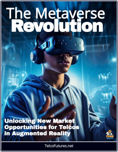
Augmented Reality (AR) and Virtual Reality (VR)
Geospatial AI powers immersive AR experiences by mapping virtual content onto real-world locations. Niantic’s Pokémon Go, for instance, uses geospatial data to place virtual creatures in physical spaces. Niantic Spatial’s ongoing work aims to enhance AR smart glasses, creating seamless overlays of digital information for gaming, education, or navigation.
Environmental Monitoring and Climate Change
By analyzing satellite imagery and sensor data, geospatial AI tracks environmental changes like deforestation, glacier retreat, or urban heat islands. It predicts natural disasters, such as floods or wildfires, and aids in disaster preparedness by modeling risk zones, enabling timely interventions to protect ecosystems and communities.
Agriculture and Precision Farming
Geospatial AI optimizes crop yields by analyzing soil conditions, weather patterns, and satellite imagery to recommend precise planting schedules, irrigation needs, or pest control measures. Drones equipped with AI can monitor fields in real time, identifying areas requiring attention to maximize efficiency and sustainability.
Logistics and Supply Chain Management
Geospatial AI enhances delivery and logistics by optimizing routes, predicting delays, and managing fleets. It integrates real-time traffic data, weather forecasts, and location-based demand patterns to streamline operations, reducing costs and improving delivery times for companies like Amazon or UPS.
Defense and Security
In defense, geospatial AI supports reconnaissance, surveillance, and mission planning by analyzing satellite and drone imagery to detect threats or map terrain. It aids in disaster response by identifying affected areas and coordinating relief efforts, ensuring resources reach those in need efficiently.
Retail and Location-Based Marketing
Businesses use geospatial AI to analyze customer movement patterns and demographic data, optimizing store locations or targeting ads. For example, retailers can identify high-traffic areas for new outlets or deliver personalized promotions to customers based on their real-time location.
Robotics and Industrial Automation
Geospatial AI enables robots to navigate complex environments, such as warehouses or construction sites, by creating real-time spatial models. Niantic Spatial’s AI-driven maps, built from crowdsourced data, could guide robots in dynamic settings, improving automation in industries like manufacturing or logistics.
Public Health and Epidemiology
Geospatial AI tracks disease spread by mapping infection hotspots and correlating them with mobility or environmental data. During pandemics, it can predict outbreak patterns and guide resource allocation, such as vaccine distribution or hospital capacity planning.
Niantic’s Vision
Niantic Spatial, born from Niantic’s 2025 restructuring, exemplifies geospatial AI’s potential. By leveraging location data from millions of Pokémon Go players, it is developing high-fidelity digital maps to support AR, robotics, and autonomous systems. This pivot highlights how crowdsourced geospatial data, combined with AI, can create scalable solutions for real-world challenges, from enhancing AR experiences to enabling precise navigation for drones or vehicles.